Regardless of what the groundhog may have said last week, winter is very much still around and will remind us of that fact this upcoming weekend and into the beginning portions of next week. If you thought it was cold outside now, wait until you see what is in store for the next few days. There is also the potential for another winter storm to impact our region early next week as I am sure you may have heard by now. While this storm doesn’t currently look to be near as disruptive as the storm we saw earlier this year, precautions do need to be taken. All in all, it will be a very good idea to stay in the know weather-wise over the next several days (if you aren’t a fan of reading, skip to the bottom of this page for a video update).
First things first, it is going to get downright cold this weekend. Our region will experience an impressively large intrusion of arctic air that will drop temperatures down significantly, especially across the area on the morning of Valentine’s Day. Temperatures that morning currently look to hover in single digits across the state, with the wind chill making it feel well below the zero degree mark for some locations. All things considered, if you must be out and about on Sunday, please be sure to stay bundled up and limit your time outdoors.

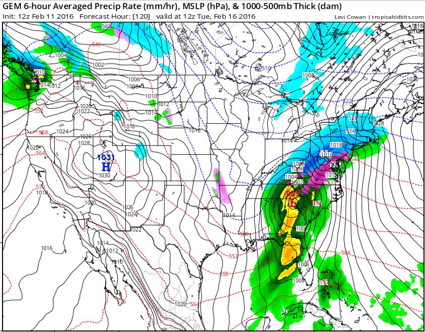
As far as next week is concerned, there is still a great bit of uncertainty within the forecast models at this point in time. What we do know is that something should begin falling from the sky Monday afternoon/evening and continue into the day on Tuesday. The big question right now is, as always with these types of storms, what track the storm decides to take. The GFS model tends to show more of a wintry mix and rain solution, which would ultimately limit any accumulating snowfall we would see. The Canadian solution suggests that the event would begin with snow Monday before transitioning to a wintry mix and rain on Tuesday. The European model suggests a great deal of cold rain for the region. Here are some screenshots from a few different model outputs:


Long story short, the various scenarios that could play out with this storm (with the latest information available) would be something like this:
- Best case scenario: main precipitation type is rain (European solution)
- Middle case scenario: main precipitation type is still rain, but light accumulations of snow and wintry precipitation possible (GFS solution)
- Worst case scenario: precipitation begins as snow, before transitioning to a wintry mix and a cold rain on Tuesday; highest snow accumulations (Canadian solution)
For those non-reading fans out there, here is a quick video from earlier today highlighting the main details I mentioned above (thanks to Carilion Clinic Homecare for the idea!):
As always, the situation will become clearer as we progress through the weekend, so please be sure to stay tuned to local media and with the National Weather Service to get the latest details as they become available. I will also do my best to keep this page updated as well as send along updates through my Twitter page (@Nickwx92). Thanks as always for tuning in and please try to stay safe and warm out there everyone!
